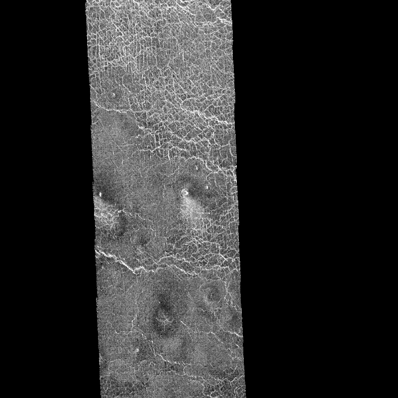
MAGELLAN/VENUS IMAGE USHAS.GIF
This Magellan image shows an area 40 by 112 kilometers (25 by 70 miles) to the northeast of Ushas Mons on Venus. It was obtained on September 16, 1990 when the spacecraft was on its 384th orbit of the planet. This image shows evidence of possible explosive volcanism and eolian or wind activity. The image shows two types of plains: fractured and smooth. The smooth plains in the center of the image appear to overlay the fractured plains. Extending from the one kilometer (0.6 mile) diameter crater in the middle of the image is a radar-bright fractured surface which broadens away from the crater. It is brighter near the crater and fades gradually into smooth plains at its distal end 10 kilometers (6 miles) from the crater. A similar but darker deposit extends away from the crater to the left. These streaks are interpreted to form due to the scouring away of the smooth plains deposit by the wind, revealing the fractured plains below. The smooth plains deposit and the craters may have formed by fallout from volcanic explosion plumes. Their characteristics are typical of terrestrial pyroclastic volcanic deposits. Resolution of the Magellan data is about 120 meters (400 feet).